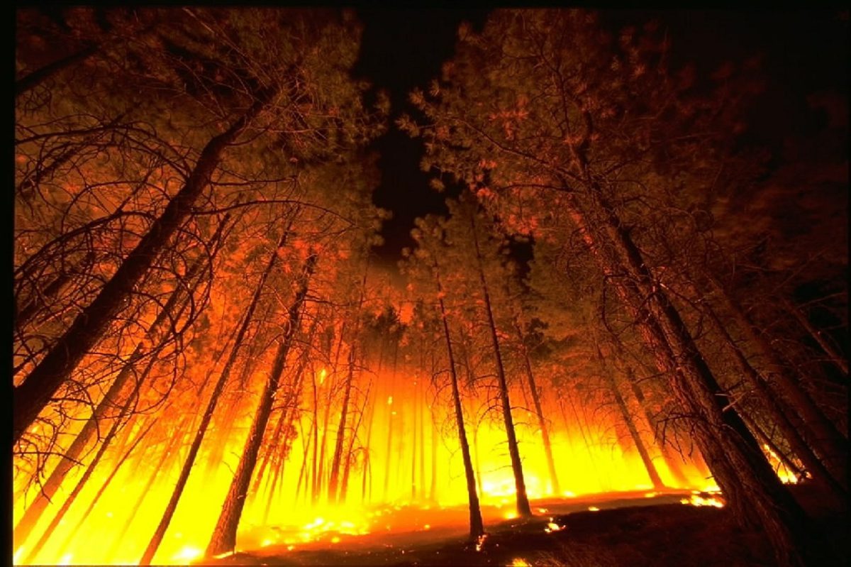
Despite its long history of wildfires, Canada still doesn’t know how to live with them

In the fall of 1922, the city of Toronto sent 85 surplus streetcars to Haileybury and other northern Ontario towns to help house thousands of desperate people who had lost their homes to wildfires.

Known as the Great Fire, it burned nearly 1,700 square kilometres of the area — including the town of Haileybury. It killed 43 people and caused millions of dollars in property damage in 18 townships. A newspaper referred to it as the “worst disaster that had ever overtaken northern Ontario.”

It was not.

The wildfires back then were as fierce, deadly and eerily similar to the ones we have today. And we have yet to learn to live with them.

Fires of the past

The Great Miramichi fire, which destroyed forests and devastated communities across northern New Brunswick in 1825, was the largest and one of the most deadly wildfires in North American history.

The Saguenay and Ottawa Valley fires in 1870 could have been just as deadly when they forced the evacuations of several thousand people. The capital city would have burned down that summer had it not been for a quick-thinking engineer who ordered the gates of the St. Louis dam on the Rideau Canal to be breached so that it would flood city streets.

Seventeen villages were levelled in Wisconsin the following year, killing between 1,200 and 1,500 people.

In 1881, the Michigan’s Thumb fires burned 1,480 barns, 1,521 houses and 51 schools, while killing 283 people and injuring many others. Smoke from those fires coloured the sky over Toronto.

In 1908, the British Columbia town of Fernie was levelled by a wildfire. In 1911, the Porcupine fire killed 73 people while levelling the towns of South Porcupine and Pottsville in Ontario before partially destroying Golden City and Porquis Junction.

There was almost no warning five years later when a deadlier complex of fires swept through the same region and killed 223 people.

Each summer and fall, it seemed, ended badly somewhere.

Déjà vu

The similarities between the fires now and then are uncanny, as described in my book Dark Days At Noon: The Future of Fire. The ignition of fires between 1870 and 1922 was fuelled by higher temperatures, drier forests and the kind of elevated lightning activity that we are experiencing today.

Much of the warming back then can be attributed to the end of the little ice age (1300 to 1850) that dramatically cooled parts of the world, and the Industrial Revolution in the late 18th and early 19th centuries.

Today, the unprecedented warming taking place is primarily because of the burning of fossil fuels.

Forest land-grabbing and negligence has also fuelled numerous fires in the past and present.

Before and beyond the turn of the 19th century, people moved into boreal and temperate forests to take advantage of cheap land and jobs in the mining and forestry sectors. Today, people are building luxurious country homes in places like the Okanagan to escape the cost of living in big cities.

Sparks from trains and the careless disposal of locomotive ash accounted for a significant number of fires in Ontario in the past. Following the Lytton fire in B.C. in 2021, the head of Canada’s Transportation Safety Board acknowledged that more work is still needed to prevent wildfires caused by trains.

Gaps in public policy

The other thing that hasn’t changed much is public policy. The Porcupine fire in 1911 as Canada’s version of the Big Burn, a complex of fires that swept through the northern Rockies of the United States in 1910 and resulted in sweeping policy changes.
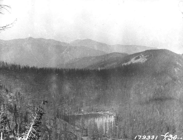
A black and white image of a mountain on fire
The destruction caused by the Big Burn of 1910 pushed the U.S. to revamp its wildfire management strategy. (Forest Service Northern Region/flickr), CC BY

Following the Big Burn, the U.S. passed the Weeks Act that authorized the government to purchase up to 30 million hectares of land to protect watersheds from development and wildfire. This mandated the U.S. Forest Service to work with state fire bureaus, which were happy to co-operate because it came with funding they could not otherwise afford.

In contrast, Canadian politicians failed to do what was necessary to prevent future fires. The government, which owned many of the railroad companies, blamed Indigenous people for many fires. Better legislation and fire management strategies were still not in place five years after the Porcupine fire when the Matheson fire took the lives of 223 people. Nor were they there in 1922, when the Great Fire devastated Haileybury.

Canada had a chance to replicate what the U.S. Forest Service was doing, but failed to as funding for fire research and management was badly decimated by budget cuts and the off-loading of responsibilities to the provinces in the 1930s.

Even today, provinces like Alberta have cut wildfire budgets to save money, only to pay the price when wildfires like the 2016 Fort McMurray wildfire, which forced the evacuation of 88,000 people.

Managing future fires

The fact that fire is still entering towns like Lytton and Fort McMurray without adequate warning suggests we have yet to learn to live with the fires that we have stoked by burning fossil fuels, draining wetlands and suppressing natural fires that would have otherwise produced more resilient forests.

Stopping Indigenous burning that aided forest regeneration didn’t help.

We are now in a unique situation where hot fires are creating their own weather — fire-driven thunderstorms and pyrogenetic tornadoes — that can spawn other fires. We saw this in Fort McMurray in 2016, in B.C. in the following years and in 2019 and 2020 when Australia’s Black Summer fire season led to a massive outbreak of fire-induced and smoke-infused thunderstorms.

This is, in a word, scary.

The title of my book Dark Days at Noon harkens back to 1780 when smoke from distant fires blocked out so much sunlight that people from all over New England thought the end of the world was at hand. The end of the world is not at hand, but there will be many more dark days at noon if we do not learn to live with fire.

Edward Struzik, Fellow, Queen’s Institute for Energy and Environmental Policy, School of Policy Studies, Queen’s University, Ontario

This article is republished from The Conversation under a Creative Commons license. Read the original article.
We can’t predict the next wildfire disaster – but we can plan for it

Jen Beverly, University of Alberta

Intense, fast-spreading fires are an enduring and natural feature of Canadian landscapes, but for most of the past 40 years, relatively few residents were evacuated each year. Yet, in the past 10 years, an unprecedented number of homes have burned in Alberta and British Columbia.

Recently, a wildfire destroyed 90 per cent of Lytton, B.C. Residents had minutes to evacuate as the fire engulfed the village. Slave Lake and Fort McMurray have also suffered enormous losses within the past decade.

As a wildfire scientist, when I look at these disasters I don’t see isolated events, or even a trend, but an abrupt shift to a completely new state. Since 2011, Western Canada has experienced a succession of extreme fire seasons with prolonged threats that affect many communities and last weeks or months.

When I think about what unfolded in Lytton and elsewhere, I am reminded of American business magnate Warren Buffett’s advice on the need to prepare for adversity: “Predicting rain doesn’t count. Building arks does.” For me, this means that efforts to predict fire risk and to prioritize mitigation efforts are not enough. Now is the time to prepare for fire disasters — wherever they are possible — and to start deciding what we will do when they happen.

Evacuations were infrequent, untracked

Twenty years ago, there were no national statistics on wildfire evacuations. The 2003 Okanagan Mountain Park Fire that consumed 239 homes in Kelowna, B.C. first exposed how little we knew about the problem. Was it an isolated anomaly or a harbinger of what was to come?

In the years that followed, my colleagues and I began to compile details from newspaper archives and records from emergency response agencies gathered from 1980 to 2007. Overall, evacuations had displaced a relatively small number of Canadians. In more than 25 years, wildfires destroyed 497 homes and prompted evacuation of just 210,000 people, the equivalent of about 18 homes and 7,500 evacuees annually. We confirmed only one civilian fatality.

That compares with roughly 3,000 homes lost in Slave Lake in 2011 and Fort McMurray in 2016. Fort McMurray also had 80,000 evacuees in 2016 and B.C. had 65,000 evacuees the following year. In Alberta, 15,000 were evacuated during the spring of 2019 alone.

Analysis of national fire numbers and area burned have revealed statistically significant increasing trends in large parts of Western Canada. Nationally, the largest fires have doubled in size since 1959. We also know that fire seasons are getting longer, with a larger number of days being conducive to the types of fast-spreading, intense fires that can threaten public safety and property.

In recent decades, there has been a surge of research studies that seek to predict how fire regimes — fire frequency, size, intensity, severity and season — can be expected to change in concert with our heating climate. Those studies certainly point to intensification of the kinds of weather extremes that produce wildfire disasters like the recent one in Lytton.

Possible catastrophes need action

Prediction has long been a cornerstone of fire research and fire management. We study the data and build complex models to identify which areas are most likely to burn today, tomorrow, this year and in the years to come. This information can help decision makers prioritize limited fire suppression resources and mitigation budgets, such as those allocated for FireSmart fuel reduction treatments.

Early in my career, I used complex computer simulation models to try to map the locations most likely to burn in the next or several years. But when we looked at where the real fires occurred in the years that followed, we discovered that most fires consumed areas assessed as having a relatively low likelihood of burning.

No matter how sophisticated, fire risk assessments are riddled with uncertainties and crippled by the inherent variability and the random nature — referred to as stochasticity — that accompany fires, weather and fuel at play.

Governments can prioritize the most at-risk communities in a region and allocate mitigation funds to the top 20, but the next disaster could very well hit community No. 21. When conditions are extreme, like the 60 km/h winds reported in Lytton, FireSmart fuel reduction treatments cannot be relied upon to protect a community from an encroaching fire.

The evacuation records taught us that these events often unfold under highly atypical conditions such as extreme wind speeds that would be ignored in risk assessments based on what is most likely. In short, if it’s possible for an area to burn at all, then you need to plan for it.

Take what you know and plan what you’ll do

So what do we know for certain? Fuels are the hazard or precondition necessary for fire, and we know where the fuels are. In this context, fuels are live and dead biomass or vegetation. We can map the fuel hazard and identify which locations of a community or landscape is exposed to potential ignitions.

This simple approach led to the creation of the FireSmart Exposure Assessment tool for informing community protection planning, and we’ve recently shown that it works for assessing large landscapes too.

My research team is currently extending that work to map potential fire pathways into communities, and in collaboration with transportation engineer Amy Kim and her students, we’re asking how the flow of fire into a community could disrupt the flow of people evacuating the area.

Our aim is to develop simple and easily computed metrics of fire exposure, fire pathways and evacuation routes to inform what-if scenarios. Agencies and communities can use these to understand vulnerabilities and develop proactive strategies for mitigation, response, containment and evacuation.

Science can inform the planning process, but ultimately these efforts will only succeed when solutions are developed locally to capture local circumstances, knowledge and needs. Rather than a burden, planning for fire can be a mechanism for growing local skills and long lasting community connections, by bringing diverse perspectives together around the common goal of a safer and more resilient future.

When it comes to wildfire threats to communities, we are navigating uncharted waters. Under extreme conditions like those across B.C. this summer, we cannot stop a spreading wildfire. When they occur, the only option is to contain it or evacuate. So start planning your route now. The Conversation

Jen Beverly, Assistant Professor, Wildland Fire, University of Alberta

This article is republished from The Conversation under a Creative Commons license. Read the original article.

Fighting Historic Wildfires Amid Bad Ideas and No Funding

The below article is by Ed Struzik. Ed will be a keynote speaker at CatIQ Connect in February 2019. http://www.catiq.com/connect

Note that this article originally appeared in The Conversation.

Shortly after my book “Firestorm, How Wildfire Will Shape Our Future” was published in late 2017, I received a flurry of invitations to speak about the challenges of dealing with fires that are burning bigger, hotter, more often — and in increasingly unpredictable ways.

The invitations came from all over, from Los Angeles to Whitehorse in the Yukon and from Campbell River on Vancouver Island, to Portland, Me.

I had serious doubts that anyone in Whitehorse would come out to hear me speak on a Saturday night in the dead of winter when it was close to -30 C.

It turned out to be standing room only.

The invite came from a group of concerned citizens, business leaders and the Yukon Science Institute. The attendees included homeowners, firefighters, emergency response personnel and Yukon cabinet minister John Streicker, who is responsible for the wildfire management division.

The discussion that followed my talk was heated at times, but it led to an open and frank conversation on how this boreal forest community, and others like it, might deal with wildfires like the one that engulfed Fort McMurray, Alta., in 2016 and those that are burning big in British Columbia this summer.

INVESTING IN THE FUTURE

More and more Canadian communities are signing up for the very sensible Fire Smart program, which promotes a variety of preventative measures such as forest thinning and the use of fire-resistant building materials to reduce the impact of fire.

Vulnerable towns like Nelson, B.C., are on the right track in developing evacuation plans and encouraging people to keep enough food and water on hand to sustain them for 72 hours. First Nations communities in B.C. are working with scientists like Lori Daniels to make their communities and forest-management zones more resilient.

But there are also a lot of poorly thought-out proposals being made.

Some residents of Jasper are pressuring Parks Canada to clear-cut the forests around town to form a fire break to protect it.

Across North America, the logging industry is lobbying governments to salvage the healthy trees and the partially burned ones that remain in a burned-out area. The rationale in this case is that a dead or dying forest has little value other than boosting a local economy.

There is a significant role for the timber industry in managing wildfire in the future. But a growing number of studies show that clear-cutting a burned-out forest is not the answer.

Fire is a natural process that makes forests more resilient to drought, disease and future fires. And it’s good for wildlife.

Woodpeckers, nighthawks and many species of owls thrive in burned-out areas. Elk and moose feed on the aspen shoots that rise up quickly after a fire. Grizzly bears and black bears benefit from the roots and berries that do well when a fire exposes the forest floor to sun and rain. Rivers and lakes tend to heat up in nasty ways when there are no trees to shade them and the cold-water fish they nurture.

There is also tendency to think that the best way of dealing with fire is to pour more money into traditional firefighting resources. When I spoke at the University of California, Los Angeles in April, many people in the audience called for more water bombers and irrigation systems.

While this helps, it’s not the whole answer. The only thing that is going to stop a big wind-driven fire that typically blows in from the east is the Pacific Ocean, Ralph M. Terrazas, the fire chief of the Los Angeles Fire Department, said during the question-and-answer session that followed.

BRAVERY ALONE WON’T KEEP WILDFIRE OUT OF TOWN

Author: Glenn McGillivray, Managing Director, Institute for Catastrophic Loss Reduction (ICLR)

On a recent long haul flight I finally broke down and watched ‘Only the Brave’, the 2017 Josh Brolin movie about the 19 wildland firefighters killed at Yarnell Hill, Arizona in June, 2013.

Up to that point, I had refused to watch the movie, thinking that it would likely romanticize wildland firefighting and demonize wildland fire.

I refused to watch the movie like I refuse to call the Fort McMurray wildfire ‘The Beast’, an overly romantic moniker coined by the now retired fire chief of that city who gave the fire the qualities of an evil, soulless creature. I didn’t (and still don’t) see the benefits of animorphizing the fire, making it seem like a rational, calculating, punitive creature. In my view, it helps no one to imply that such a fire is some kind of intentional being with a mind of its own. We won’t work to prevent such an event from reoccurring with such a mindset.

I remain dedicated to not calling the Fort McMurray fire that name, though I admit I was largely wrong about the movie. It is a pretty good flick, though there is one part where the fire superintendent (played by Brolin) looks over the expanse of scrub in his protection zone and says something to the effect that he and his crew “protect all of this.’

The idea of ‘protecting’ a forest against fire is largely the wrong stance to take (especially in Canada’s boreal forest, which needs fire for its own good). It is this ‘suppression at all costs’ mentality that has gotten many North American jurisdictions into the mess they are currently in, i.e. where years of successful suppression has ensured that wildlands are choked with fuel that’s now just waiting to go up like a tinder. In large measure, saying we need to stop fire on the landscape is akin to saying we have to stop the wind or the rain.

But I don’t wish to spend my time here talking about the issue of suppression. I deal with that here.

Instead, I want to put forth an idea of how we can better understand the interface fire problem (i.e. the issue of fire getting into communities), at least partly by looking at what we’ve learned from the past.

In the distant past, several major cities, mostly in Western Europe and North America, have experienced large conflagrations caused by one thing or another (like rambunctious cows). Fires in such places as London, New York, Toronto, Chicago and San Francisco lead to many changes in how cities are designed, how buildings are constructed, and in fire education and safety.

I suspect that these fires were largely viewed in technical terms and, thus, were seen as addressable, where measures could be put into place to prevent or, at the very least, reduce the risk of reoccurrences.

Firewalls were placed within and between buildings; openings (like small windows) were limited on the exposure sides of buildings; fire doors became common; buildings were outfitted with fire alarms, suppression equipment with dedicated water supplies and, from the late 19th century, sprinkler systems; less wood was used in construction; open flames were limited, and so on. Parallel to these efforts came the rise of education programs to inform people about the risk of fire and actions they could take to limit ignitions and spread. Over time, both the frequency and severity of urban fires dropped precipitously, to the point where fires are no longer a major cause of death and the main cause of insured property damage in most industrialized countries.

These actions are essentially early examples of risk management and are largely still in practice today. Indeed, it is still common for the risk manager of, say, a factory or mill to do a walk around of a site and make recommendations about how to prevent ignition and spread of fire.

But we don’t take this approach with homes in the interface. Why?

First, wildfires are viewed as ‘natural disasters’, and there is a widespread view that “nothing can be done about natural disasters” – they occur at the whim of Mother Nature. Really, though, a wildfire is a natural hazard, the disaster comes when the hazard exploits manmade vulnerabilities. I think the view that losses are inevitable when a hazard strikes is leading to inaction when it comes to wildland fire. For some reason, we treat the prevention of interface fires differently than we treat the prevention of other fires. But fire is fire.

Second, people have a misconception about wildfires and the interface, believing that wildland fires roll through the forest, hit a built up area and keep rolling. But what largely happens is that embers from the wildfire are blown far ahead of the fire front and ignite flammable materials located around structures. These materials then either ignite the structure directly, or ignite something else (like a wood shed or deck) that in turn ignites the structure. This is what largely occurred in Fort McMurray. It is also what occurred in the Tubbs Fire in Northern California in October 2017, except the embers travelled very deeply into the urban core of Santa Clara, leading to the incineration of about 2,800 homes, mostly in the Low Risk part of town (as designated by the city’s statutory state wildfire risk maps). These maps apparently did not take the state’s often intense Santa Ana winds into consideration.

Once you realize that wildfires are not juggernauts that roll through town like a steamroller and that structural ignitions from wildfire embers are preventable, then you can put programs into place to address the issue of flammability of individual structures, subdivisions and entire communities located in the interface.

One problem I see is that we may be talking too much to the wrong folks; to wildland fire experts and not to structural fire experts, fire modellers and other urban fire experts.

Now don’t get me wrong. Wildland fire experts, including fire ecologists and wildland fire suppression experts, are key throughout the entire lifecycle of a wildland fire – (long) before, during and (long) after. And we need to recognize that the condition and health of the forest around the interface community will largely dictate how intense the fire will be, the rate at which it spreads, and the amount of embers that are produced (the greater the fine fuels, the more embers).

But once a wildland fire gets into town, the fire stops being a forest fire and starts a new life as an urban fire, possibly becoming an urban conflagration or ‘firestorm’ if enough structures are ignited (often via structure to structure spread of fire).

So we have to recognize that once the fire hits town, it becomes a different fire, feeding on different fuels (like structures and vehicles). A fire ecologist, for example, has no expertise in the mechanisms that lead to structural ignition and spread of fire in an urban setting.

Thus, we need to bring structural or urban fire departments and experts into the discussion and leverage their knowledge (of course, many are already involved in the discussion, but many are not).

We have to pull in such organizations as the Canadian Association of Fire Chiefs, the Aboriginal Firefighters Association of Canada and their provincial counterparts, as well as provincial firefighter associations.

We need to bring in such researchers as fire modellers, to better understand how fire grabs hold and spreads in urban areas (we know what causes structures to ignite, but need to do more to understand how entire subdivisions are lost) and the sequence of such spread. Some work has already been done in the fire following earthquake research area, and much of the learnings there can be carried over to wildland urban interface fire research.

Essentially, we need to take the same approach with wildland fire in interface communities as we do with all other urban fires, including urban conflagrations.

This can only start by talking to the right people.

IMPROVING SAFETY THROUGH SIMULATING WILDFIRE RESPONSE

Improving Safety Through Simulating Wildfire Response

Steven Gwynne, Ph.D., Research Officer, NRC Construction – Fire Safety, National Research Council Canada

Wildland fires represent an important safety issue in many regions of the world – including Canada. This is complicated by the current location and possible future expansion of wildland-urban interfaces (WUI) posing severe challenges from a community evacuation perspective. Large WUI fires, like the recent Fort McMurray fire, are associated with severe negative consequences including massive community evacuation, property losses, social disruption, short- and long-term damage to infrastructure, injuries, and in some instances fatalities of evacuees and responders. Tools to assist planning and response are essential to provide evidence to planners, evacuees and responders to better address these challenges.

As we go forward, it is expected that droughts will get more severe and prolonged, thunderstorms more frequent, wind patterns will change and harsh hot seasons will affect new regions. Current trends in community planning show that more people are inhabiting areas that are now or soon to be vulnerable to WUI incidents. Housing developments in WUI areas are particularly appealing given their low cost, access to recreational pursuits, and the aesthetic benefits of being closer to nature. Therefore, WUI incidents are likely to become more severe and affect new areas and those areas already susceptible to wildfires.

The social and physical geography associated with WUI communities present a special challenge that needs to be addressed when ensuring life safety. In order to successfully respond to a wildfire incident, those involved must have an understanding of current and future events enabling them to reach safety or facilitating others to do so. Decisions made during community planning, property upkeep, emergency planning, public education, responder training, and during the evacuation itself are all heavily reliant on the information available. To ensure that this preparation and response is adequate, the effectiveness of the pre-incident decisions and decisions taken during the incident needs to be understood to allow assessment of these decisions before they are finalised and executed; i.e. before they are put into practice in the real-world. This effectiveness is reliant on the accuracy and completeness of the information available.

Very often, the wisdom derived from previous wildfire disasters is the only available source to identify current scenarios of interest and plan the response of a given community. However, there is no guarantee that these past experiences correlate well with the next disaster to be faced or with the conditions that might contribute to the outcome of the incident in the current context – especially given the expected evolution of WUI incidents. In this context, a simulation framework that can establish evacuation performance ahead of time, and that is capable of examining different designs and response scenarios would be very useful. Such a computational framework might be used to predict how the evacuation develops based on different fire scenarios (different origin, speed, development, etc.) and according to different evacuation decisions (e.g., staggered evacuation by neighbourhoods, the arrangement of traffic flow on highways, or the appearance of congestion). Moreover, current resources do not allow for the impact of procedural decisions to be assessed (and quantified) before they are executed; i.e. how conditions might evolve and might affect and be affected by an evacuating community. This is an important limitation in current approaches – that cater to understanding the current situation but cannot provide numerical evidence to support procedural decisions given forecasted changes in conditions. To do this, simulation tools are needed to explore the development of a wildfire, and the impact that it has on the response (e.g. evacuation using vehicles or on foot) – to identify current and future vulnerabilities and inform ways of addressing it. This might then provide an additional tool for planners and responders in their attempts to address WUI life-safety issues as we go forward.